Property Details
Ballan Vic 3342
POADescription
28 Denholms Road, Ballan
Cropping - Ballan Vic
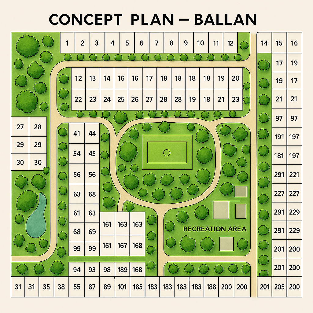
Concept Plan
What we know about 28 Denholms Road in the planning context
28 Denholms Rd sits within the Ballan township growth area, and its future is shaped by the Ballan Strategic Directions and the Ballan Framework Plan.
There is no site‑specific amendment currently active for 28 Denholms Rd, but the land falls within broader precinct planning.
Below are the direct sources relevant to Ballan’s future growth, township boundary changes, and precinct planning that affect Denholms Rd.
- Ballan Strategic Directions – Amendment C88 (Panel Report)
This is the key document shaping Ballan’s long‑term land‑use planning, including growth precincts near Denholms Rd.
Direct link:
https://www.moorabool.vic.gov.au/files/assets/public/planning/amendments/c88/c88-panel-report.pdf (moorabool.vic.gov.au in Bing)
Relevant points:
- Discusses Precincts 6, 7, 8, 9, which sit around the eastern and southern edges of Ballan — the area Denholms Rd connects into.
- Includes analysis of township boundary changes to the east, which directly influences Denholms Rd.
- Covers land supply, growth sequencing, and infrastructure planning.
- Moorabool Planning Scheme – Ballan Framework Plan (Clause 11.01‑1L‑03)
This is the statutory framework that identifies Ballan’s long‑term residential growth areas.
Access via Moorabool Planning Scheme:
https://www.moorabool.vic.gov.au (moorabool.vic.gov.au in Bing)
(Navigate: Planning → Moorabool Planning Scheme)
Relevant points:
- Identifies future residential precincts around Ballan, including land south‑east of the township.
- Shows Precinct 5, 6, 7, 8, 9 — the areas that influence Denholms Rd’s future zoning potential.
- Provides the official growth boundary and preferred land‑use patterns.
- Amendment C108 – Future Residential Development (Ballan South‑East Growth Area)
While not directly naming Denholms Rd, this amendment covers land immediately south and east of Ballan, which is the same growth corridor.
Direct link to C108 information:
https://www.moorabool.vic.gov.au (moorabool.vic.gov.au in Bing) (search “C108”)
Relevant points:
- Rezones 98.5 ha from Rural Living Zone → Neighbourhood Residential Zone.
- Applies Development Plan Overlay (DPO9).
- This is the closest active amendment to Denholms Rd and signals the direction of future rezonings.
- McFall Real Estate Listing – 28 Denholms Road Concept Plan
This is not a planning authority source, but it shows that a concept plan exists, indicating development interest.
Listing reference:
https://www.mcfallrealestate.com.au (mcfallrealestate.com.au in Bing) (search “28 Denholms”)
Relevant points:
- Confirms the property is being positioned as future development land.
- Notes that information may be AI‑generated and requires verification.
What this means for 28 Denholms Rd
Based on the above sources:
✔ The land sits in Ballan’s future growth corridor
The Ballan Strategic Directions and Framework Plan show the township expanding east and south, directly toward Denholms Rd.
✔ No active rezoning yet
There is no current amendment specifically targeting 28 Denholms Rd.
✔ But the area is flagged for future residential investigation
Precincts 6–9 in the C88 report and the Framework Plan indicate future residential potential, subject to:
- servicing (water, sewer, drainage)
- road upgrades
- sequencing of growth
- strategic justification
Please note information may be AI generated. all information requires your own due diligence and professional advice.
contact joe@mcfallrealestate.com.au
Property Features
- Cropping